
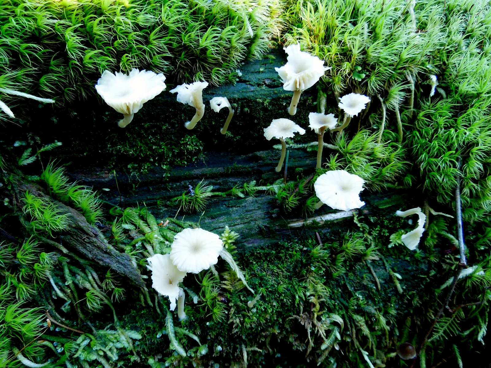
Photos of things you see along the trails in Western Washington
Trails from Day Hiking Olympic Peninsula guidebook by Craig Romano

Lena Lake Trail: This is hike 37 in the guidebook. Lena Lake Trail is an easy 6 mile roundtrip with 1,225 feet of elevation change. Lena Lake is a small backcountry lake surround by fir and cedar trees. The trail is easy to follow and well maintained. As you near the lake you will find good view points to rest and enjoy the lake view.

Murhut Falls and Fallsview Trails: This is hike 43 in the guidebook. Murhut Falls Trail is a very easy 1.6 miles roundtrip with 300 feet of elevation change. The waterfall has two parts. The upper falls drops 100 feet and the lower falls adds another 30 feet.
Fallsview Falls area has two small trails. They are not part of hike 47 above. The Fallsview Loop Trail near the campground is .1 mile roundtrip with almost no elevation change. This trail offers a view across Fallsview Canyon of a small creek cascading 100 feet down to the Big Quilcene River. The Fallsview Canyon Trail is 1.5 mile roundtrip with 300 feet of elevation change. It takes you down to the bottom of the canyon next to the Big Quilcene River.

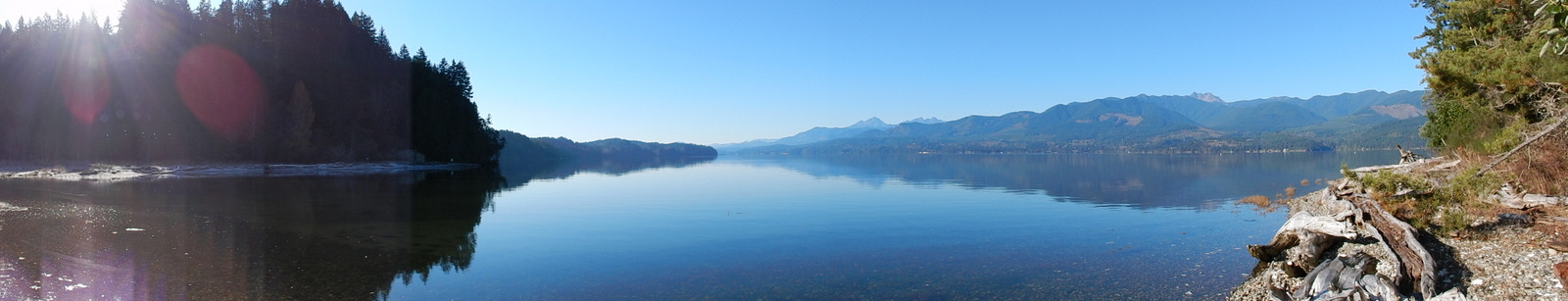
Duckabush River Trail: This is hike 48 in the guidebook. The Duckabush River Trail is 10.6 miles roundtrip with 2300 feet of elevation change. However, there is a very nice turnaround point next to the river at about 3 miles for a total roundtrip of 6 miles. This turnaround eliminates 1000 feet of elevation gain and makes for a much easier hike. This trail is well maintained and easy to follow.
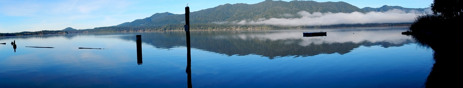
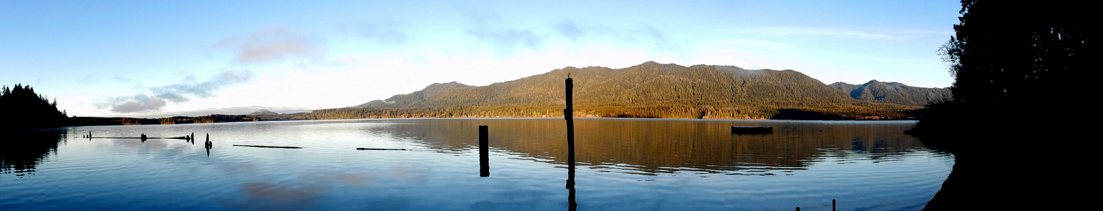
Dosewallips State Park Trail: This is hike 49 in the guidebook. The Dosewallips State Park Trail is 3.5 miles roundtrip with 400 feet of elevation change. The trail is easy to follow and well maintained.

Tunnel Creek Trail: This is hike 55 in the guidebook. The Tunnel Creek Trail is 8.5 miles roundtrip with 2450 feet of elevation change. However, there is a very nice turnaround point at a bridge that crosses Tunnel Creek about 3 miles for a total roundtrip of 6 miles. This turnaround eliminates 1000 feet of elevation gain and makes for a much easier hike. This trail is well maintained and easy to follow.

Notch Pass Trail: This is hike 56 in the guidebook. The Notch Pass Trail is 8.6 miles roundtrip with 3000 feet of elevation change. You can avoid 1000 feet of elevation gain by turning around once you reach Notch Pass at the 2.1 mile mark. However, you have to gain 2000 feet in 2.1 miles to reach Notch Pass. The trail is easy to follow and well maintained.

Lower Big Quilcene River Trail: This is hike 57 in the guidebook. Lower Big Quilcene River Trail is 12.4 miles roundtrip with 1,300 feet of elevation change. However, there is a very nice turnaround point called Camp Jolley next to the river at about 4.7 miles for a total roundtrip of 9.4 miles with 800 feet of elevation change. In many places the river can be seen from the trail. The trail is easy to follow and well maintained.

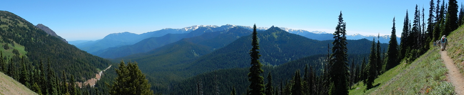
Marmot Pass Trail: This is hike 58 in the guidebook. The Marmot Pass Trail is a fairly difficult 10.6 miles roundtrip with 3500 feet of elevation change. The trail is a steady uphill all the way to Marmot Pass. The trail runs along the Big Quilcene River for 2.5 miles and then begins a steady climb to Marmot Pass. The trail is easy to follow and well maintained.

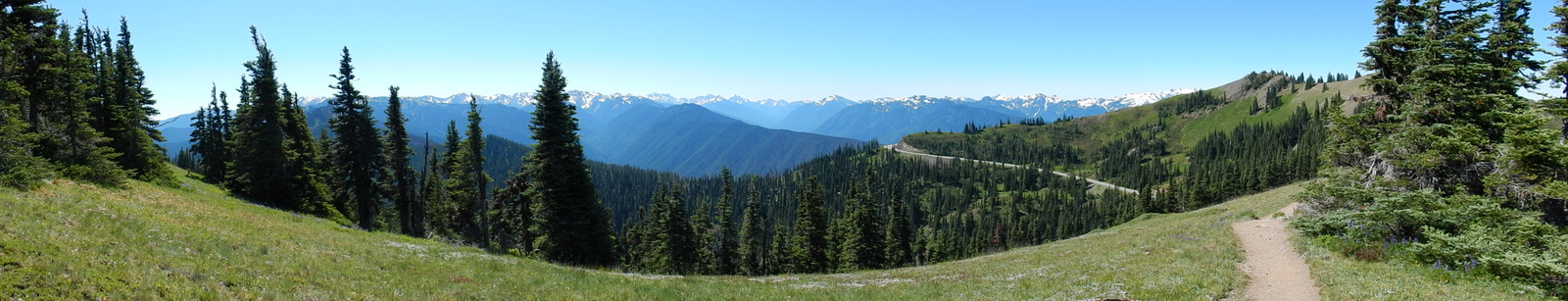
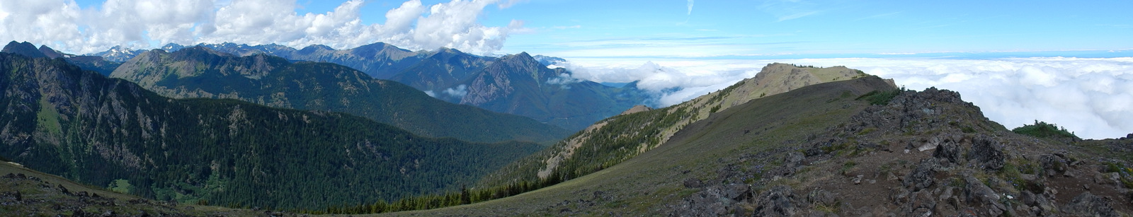
Mount Townsend Trail: This is hike 59 in the guidebook. The Mount Townsend Trail is 8.2 miles roundtrip with 2900 feet of elevation change. Once you get above the tree line at around the 1 mile mark there are beautiful views of the surrounding area. If you decide not to reach the 6280 foot summit, you will still have a great hike.

Mount Zion Trail: This is hike 61 in the guidebook. The Mount Zion Trail is 4.6 miles roundtrip with 1300 feet of elevation change. The summit is reach at the 1.8 mile mark. Unfortunately, the view is blocked by the trees. You can however hike .5 miles to another outlook that provides wonderful views of Mount Townsend and Gray Wolf Ridge. This trail is well maintained and easy to follow.

Tubal Cain Mine and Buckhorn Lake Trail: This is hike 63 in the guidebook. The Tubal Cain Mine and Buckhorn Lake Trail is 12 miles roundtrip with 2000 feet of elevation change. Our club did not hike all the way to the Tubal Cain Mine or Buckhorn Lake. We hiked to the 3 mile mark and then took a .7 mile side trip to Tull Canyon to view a crashed B-17 and an abandoned mine. The side trip was steep but worth the climb.
Upper Dungeness River Trail: This is hike 64 in the guidebook. Upper Dungeness River Trail is 6.8 miles roundtrip with 600 feet of elevation change. The river can be viewed and heard all along the trail. The trail is easy to follow and well maintained.


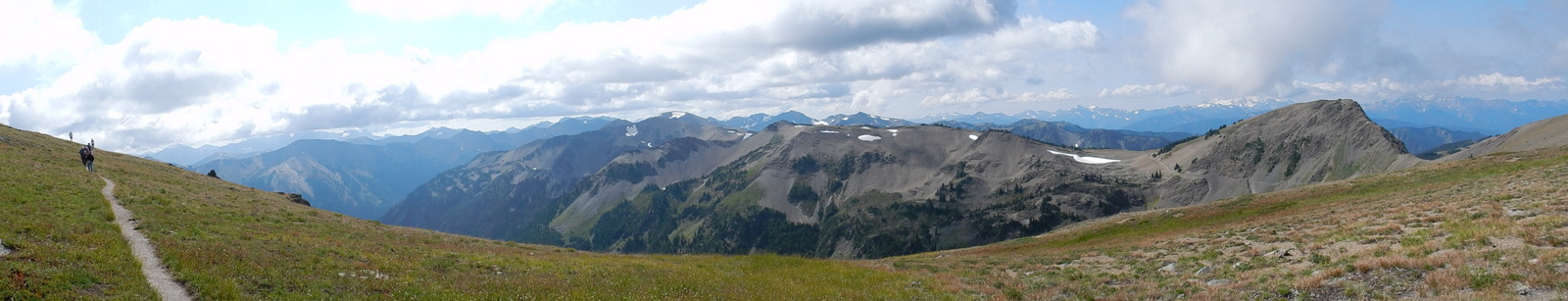
Royal Basin Trail: This is hike 65 in the guidebook. The Royal Basin Trail is 14 miles roundtrip with 2650 feet of elevation change. At the 5 mile mark the trail steepens significantly, so this is a good turnaround point for hikers that do not want to hike the entire trail. The hike to this point is well worth the effort.

Gray Wolf Trail: This is hike 67 in the guidebook. The Gray Wolf Trail is 8.4 miles roundtrip with 800 feet of elevation change. At the 3.5 mile mark the trail steepens, so this is a good turnaround point for hikers that do not want to hike the entire trail. The hike to this point is some of the best riverside hiking in the Olympics.

Slab Camp Creek and Upper Gray Wolf River: This is hike 69 in the guidebook. The Slab Camp Creek and Upper Gray Wolf River Trail is 5.6 miles roundtrip with 1100 feet of elevation change. Most of the way the trail follows Slab Camp Creek. Along the way the Creek can be seen and heard which makes for a pleasant hike. At the 2.8 mile mark you cross the Gray Wolf River on a sturdy iron-beamed bridge. Shortly after crossing the bridge it is time to turnaround and head back to the trailhead and home.

Fort Flagler Trail: This is hike 73 in the guidebook. The Fort Flagler Trail is 5 miles roundtrip with 150 feet of elevation change. Altogether there are over 7 miles of trail available with multiple alternate routes to choose from. The 5 mile guidebook route is a loop trail that passes by multiple points of interest.
Miller Peninsula and Thompson Spit: This is hike 75 in the guidebook. The Miller Peninsula and Thompson Spit Trail is 5 miles roundtrip with 360 feet of elevation change. The hike begins at a new trailhead that did not exist when the guidebook was published. Part of the hike is through thick stands of second growth forest. There is also a part of the trail, just before you reach the Strait of Juan de Fuca, that wanders through a very nice fern lined canyon.
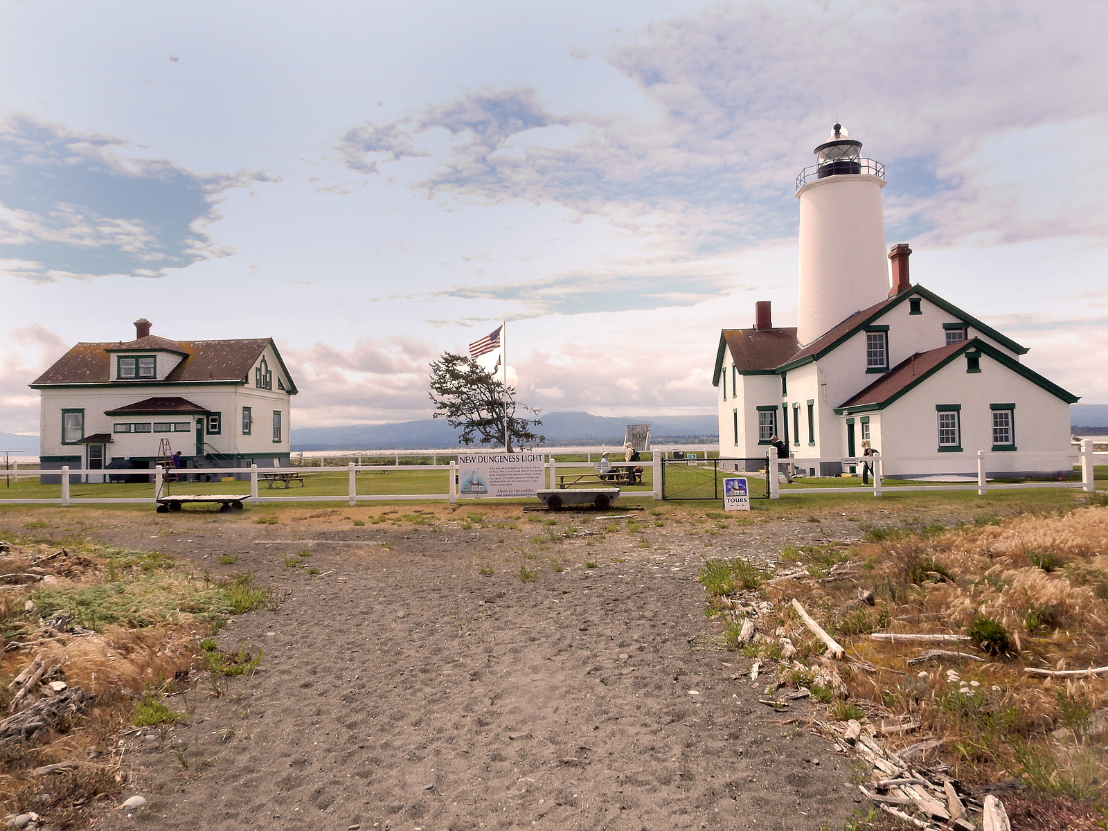
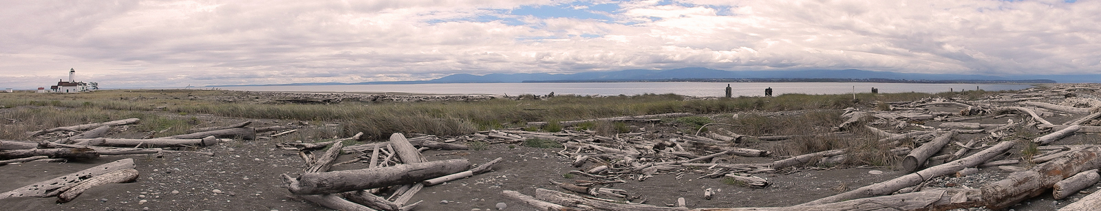
Dungeness Spit Trail: This is hike 76 in the guidebook. The Dungeness Spit Trail is 11 miles roundtrip with 130 feet of elevation change. The trail isn’t so much a trail as it is a walk along the beach. The beach leads to a lighthouse. The lighthouse was built in 1857 and it is still used today. The spit of land that goes to the lighthouse has the Strait of Juan de Fuca on one side and the Dungeness National Wildlife Refuge on the other.

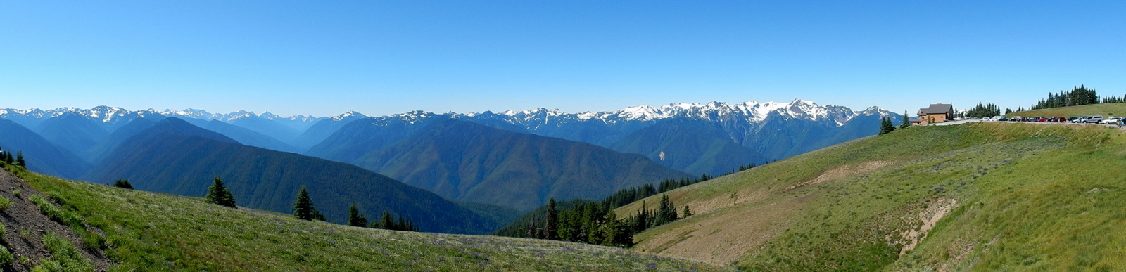
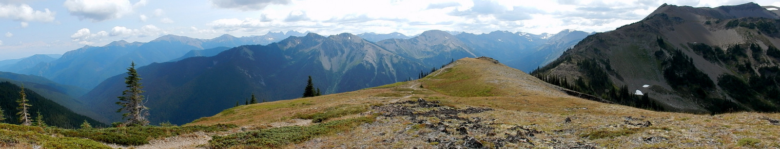
Sunrise Ridge Trail: This is hike 82 in the guidebook. The Sunrise Ridge Trail is 5.2 miles roundtrip with 1000 feet of elevation change. This hike offers some of the best views in the Olympics: Strait of Juan de Fuca, Vancouver Island, Mount Baker, Mount Olympus, Mount Angeles and more. And, in summer it is blanketed with many types of wildflowers.

Grand Ridge Trail: This is hike 85 in the guidebook. The Grand Ridge Trail is 5 miles roundtrip with 700 feet of elevation change. The hike begins at Obstruction Point. There is an option that the hiking club uses to extend the hike to Deer Park for total one way hike of 7.5 miles. When this option is used it is necessary to have transportation available at Deer Park. Like Sunrise Ridge, this hike offers some of the best views in the Olympics. And, in summer it is blanketed with many types of wildflowers.

Marymere Falls and Barnes Creek Trails: This is hike 96 in the guidebook. This section is made up of two trails. The Marymere Falls Trail is 2 miles roundtrip with 200 feet of elevation change. The Barnes Creek Trail is 6 miles roundtrip with 800 feet of elevation change. Both hikes begin at the same trailhead. At the .7 mile mark, take the Marymere Falls Trail an additional .3 miles to the base of the waterfall. Or, continue on the Barnes Creek Trail for some wonderful creekside hiking.
Quinault National Recreation Trails: This is hike 109 in the guidebook. The Quinault National Recreation Trail is 3.9 miles roundtrip with 300 feet of elevation change. This trail wonders through the Quinault rain forest that has giant Sitka spruce, Doug-fir, western red cedar, and western hemlock trees. The trail can be extended an additional 6 miles roundtrip to the world’s largest Sitka spruce.
Trails not from Day Hiking Olympic Peninsula guidebook by Craig Romano

Adventure Route Trail: This trail is not in the guidebook. Instead it is a small section of the Olympic Discovery Trail west of Port Angeles. The Adventure Route section was opened in 2008 and it spans 25 miles. When completed the total Olympic Discovery Trail will span from Port Townsend to La Push (126 miles one way). The photos are from a small portion of the Adventure Route.

Port Ludlow Trails: These trails are not in the guidebook. However, there is a free trail map (see map) available at several locations in Port Ludlow: Bay and Beach Clubs, Timberton Loop trailhead, Port Ludlow RV Park, and others. Altogether there are 25 plus miles of trails in Port Ludlow.

Larry Scott Trail: This trail is not in the guidebook. The Larry Scott Trail is 16 miles roundtrip with very little elevation change. There are three trailheads available (see map). This is a wide very well maintained trail.

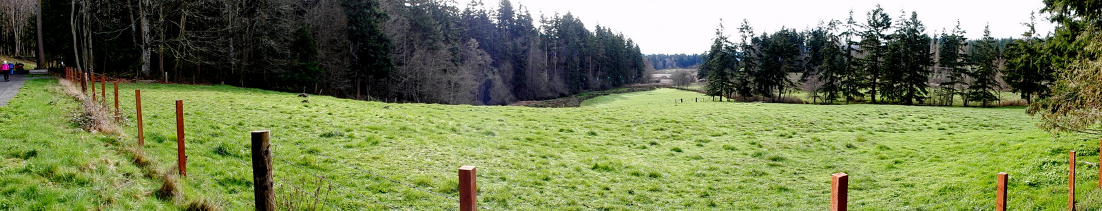
Fort Townsend Trails: These trails are not in the guidebook. The Fort Townsend State Park has 6.5 miles of trails and 3,960 feet of shoreline. The trails are mostly through old-growth forest. The trails are well marked and maintained.

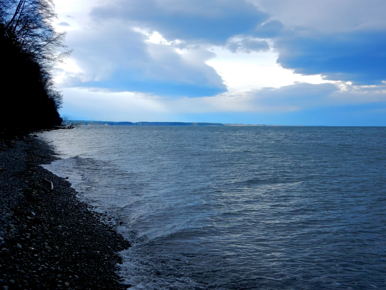
Ebey's Landing Trail: This trail is not in the guidebook. The Ebey’s Landing Trail is 3.7 miles roundtrip with a couple of hundred feet of elevation change. This trail begins along a beautiful bluff that overlooks the Puget Sound and the return trip is along the beach. In addition to the Puget Sound, the hike offered great views of Mount Baker, the Cascade Range and the Olympic peaks.

Hood River Adventure Trails: These trails are not in the guidebook. The Hood River area offers miles of trails plus views of the Columbia River and Mount Hood. There are also multiple waterfalls in the area.

Packwood Getaway Trails: These trails are not in the guidebook. The Packwood area offers miles of trails plus wonderful views of Mount Rainier. There are also multiple waterfalls and small alpine lakes in the area.

Olympic Discovery Trail: This trail is not in the guidebook. When completed the Olympic Discovery Trail will spans from Port Townsend to La Push (126 miles one way). Currently, 69 miles of this trail are completed. The photos are from a portion of the trail near Sequim.

Upper Dosewallips River Road Trail Hike: This trail is not in the guidebook. The hike is over 10 miles roundtrip with around 2,000 feet of elevation change. This hike begins where the original road to the Upper Dosewallips trailhead washed out several years ago. The hike is now on the road past the washout section. The road past the washout is wide and well maintained.
Bloedel Reserve Hike: This hike is not in the guidebook. Instead it is a walking tour of the Bloedel Reserve forest garden on Bainbridge Island. The walk includes a tour of the Bloedel home which is now the visitor center. It is an easy couple of mile walk with lots of time to enjoy the scenery.
